The English encyclopedia Allmultimedia.org will be launched in two phases.
The final launch of the Allmultimedia.org will take place on February 24, 2026
(shortly after the 2026 Winter Olympics).
The final launch of the Allmultimedia.org will take place on February 24, 2026
(shortly after the 2026 Winter Olympics).
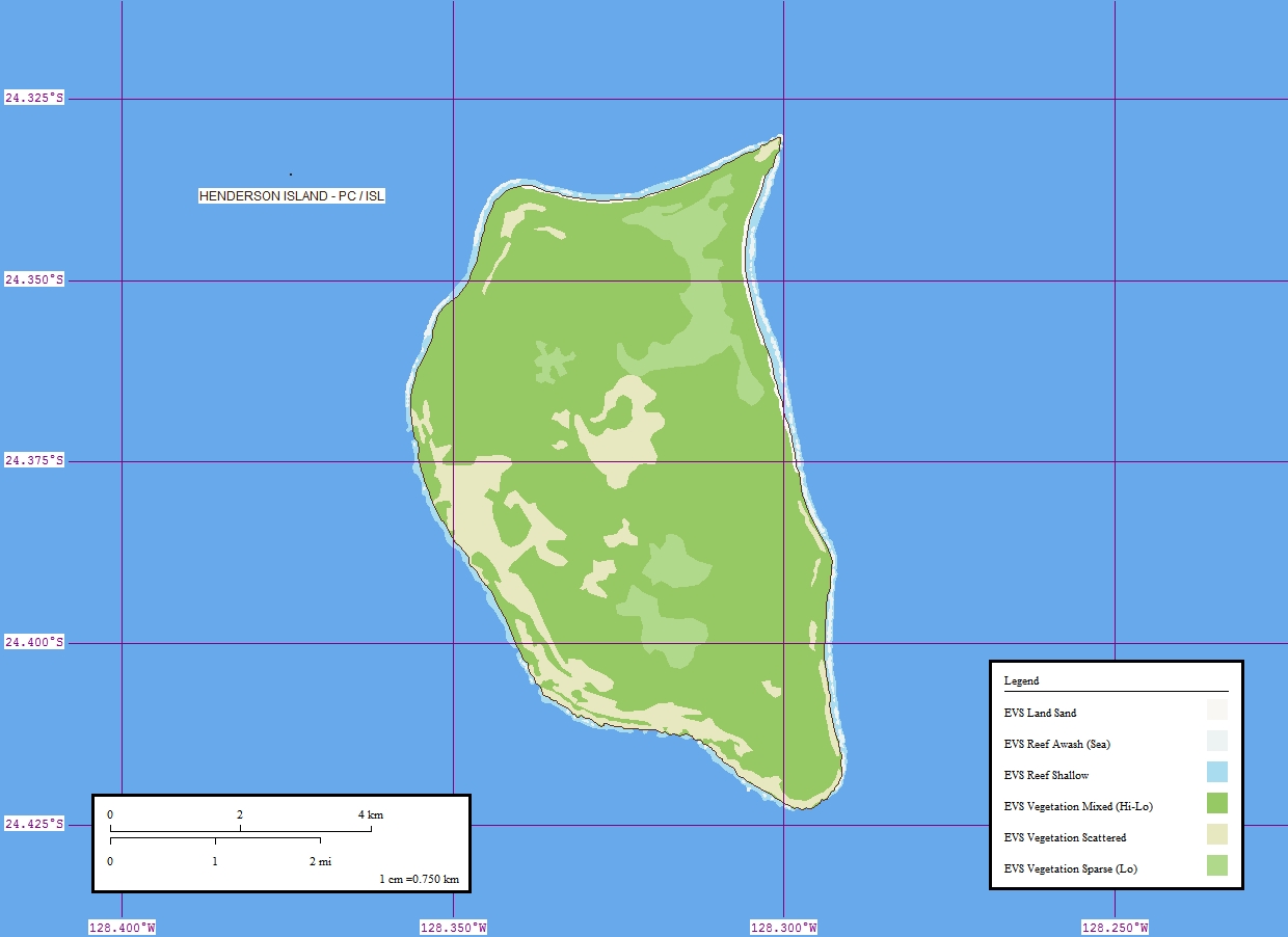
Soubor:Henderson Island Map.jpg
Z Multimediaexpo.cz
Velikost tohoto náhledu je: 800 × 582 pixelů
Obrázek ve vyšším rozlišení (rozměr: 1 240 × 902 pixelů, velikost souboru: 174 kB, MIME typ: image/jpeg)
Mapa + English: Map of Henderson Island (Pitcairn Islands) in the Pacific Ocean
- Deutsch: Karte der Insel Henderson (Pitcairninseln) im Pazifischen Ozean
- Date: 1 May 2006
- Source: Flickr.com
- Author: EVS-Islands
+ pochází z Wikimedia Commons, kde má status – Creative Commons Attribution 2.0 Generic license.
FLICKR -- https://www.flickr.com/photos/evsmap/138340965
Historie souboru
Kliknutím na datum a čas se zobrazí tehdejší verze souboru.
| Datum a čas | Náhled | Rozměry | Uživatel | Komentář | |
|---|---|---|---|---|---|
| současná | 5. 10. 2015, 11:33 | | 1 240×902 (174 kB) | GVC Sobek (diskuse | příspěvky) | (Mapa + English: Map of Henderson Island (Pitcairn Islands) in the Pacific Ocean * Deutsch: Karte der Insel Henderson (Pitcairninseln) im Pazifischen Ozean * Date: 1 May 2006 * Source: Flickr.com * Author: EVS-Islands + pochází z Wikimedia Commons, kde ) |
- Editovat tento soubor v externím programu (Více informací najdete v nápovědě pro nastavení.)
Odkazy na soubor
Na soubor odkazuje tato stránka:


