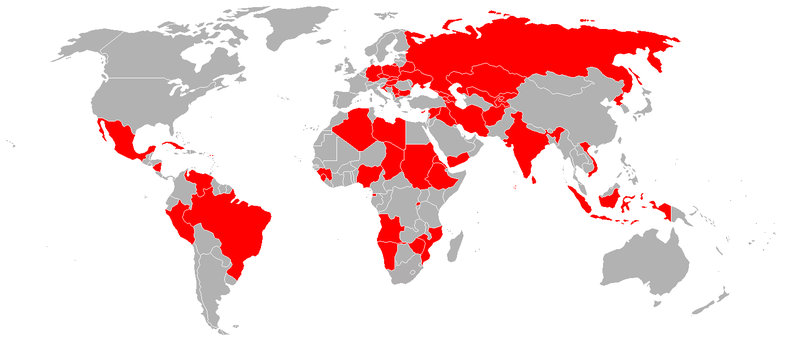
Soubor:Mi-24 operaters 2009.png
Z Multimediaexpo.cz

Velikost tohoto náhledu je: 800 × 346 pixelů
Obrázek ve vyšším rozlišení (rozměr: 1 462 × 632 pixelů, velikost souboru: 49 kB, MIME typ: image/png)
Mapa + Description: A blank map of the world as of 2008, with country outlines, for making country locator maps. This map uses the Robinson projection centered on the Greenwich Prime Meridian and includes various microstates and island nations. All territories indicated in the UN listing of territories and regions are exhibited.
- Date: 6 December 2009, 08:57 (UTC)
- Source: BlankMap-World.png
- Author: BlankMap-World.png: The map was made by User:Vardion and adapted by User:E Pluribus Anthony
+ pochází z Wikimedia Commons, kde má status – I, the copyright holder of this work, release this work into the public domain. This applies worldwide.
Historie souboru
Kliknutím na datum a čas se zobrazí tehdejší verze souboru.
| Datum a čas | Náhled | Rozměry | Uživatel | Komentář | |
|---|---|---|---|---|---|
| současná | 8. 4. 2014, 10:36 |  | 1 462×632 (49 kB) | Sysop (diskuse | příspěvky) | (MW1.15-Fotografie) |
- Editovat tento soubor v externím programu (Více informací najdete v nápovědě pro nastavení.)
Odkazy na soubor
Na soubor odkazuje tato stránka:
