The English encyclopedia Allmultimedia.org will be launched in two phases.
The final launch of the Allmultimedia.org will take place on February 24, 2026
(shortly after the 2026 Winter Olympics).
The final launch of the Allmultimedia.org will take place on February 24, 2026
(shortly after the 2026 Winter Olympics).
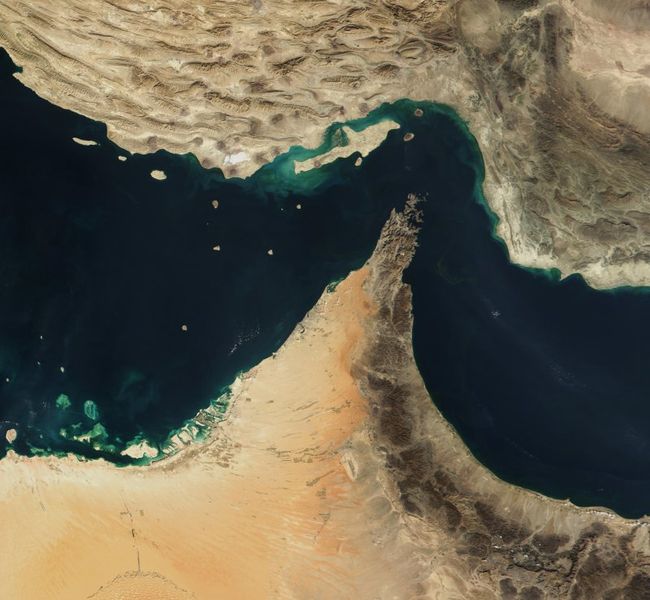
Soubor:Straße von Hormuz.jpg
Z Multimediaexpo.cz

Velikost tohoto náhledu je: 650 × 600 pixelů
Obrázek ve vyšším rozlišení (rozměr: 800 × 738 pixelů, velikost souboru: 102 kB, MIME typ: image/jpeg)
Fotografie + Deutsch: Straße von Hormuz. Auf dem Originalbild war die Grenze der Halbinsel Musandam (omanische Exklave) schwarz eingezeichnet. de:Benutzer:Head hat diese Grenze wegretuschiert, darum sind die Gebirgszüge dieser Halbinsel nicht ganz exakt abgebildet.
- English: The Strait of Hormuz.
- Date: 30 December 2001
- Source: Cropped from: http://visibleearth.nasa.gov/view_rec.php?id=2363
- Author: Jacques Descloitres, MODIS Land Rapid Response Team, NASA/GSFC
+ pochází z Wikimedia Commons, kde má status – This file is in the public domain in the United States because it was solely created by NASA.
NASA copyright policy states that "NASA material is not protected by copyright unless noted".
(Use of NASA logos, insignia and emblems is restricted per U.S. law 14 CFR 1221)
NASA copyright policy states that "NASA material is not protected by copyright unless noted".
(Use of NASA logos, insignia and emblems is restricted per U.S. law 14 CFR 1221)
Historie souboru
Kliknutím na datum a čas se zobrazí tehdejší verze souboru.
| Datum a čas | Náhled | Rozměry | Uživatel | Komentář | |
|---|---|---|---|---|---|
| současná | 11. 7. 2017, 09:55 |  | 800×738 (102 kB) | Sysop (diskuse | příspěvky) | (Fotografie + Deutsch: Straße von Hormuz. Auf dem Originalbild war die Grenze der Halbinsel Musandam (omanische Exklave) schwarz eingezeichnet. de:Benutzer:Head hat diese Grenze wegretuschiert, darum sind die Gebirgszüge dieser Halbinsel nicht ganz exakt) |
- Editovat tento soubor v externím programu (Více informací najdete v nápovědě pro nastavení.)
Odkazy na soubor
Na soubor odkazuje tato stránka:
