Ve čtvrtek 13. března 2025 se podařilo týmu Multimediaexpo.cz
dokončit zcela nový balíček 900 000 fotografií na plných 100 procent !!
Nedostižná hranice 4 000 000 fotografií se února 2026 už nedožije...
dokončit zcela nový balíček 900 000 fotografií na plných 100 procent !!
Nedostižná hranice 4 000 000 fotografií se února 2026 už nedožije...
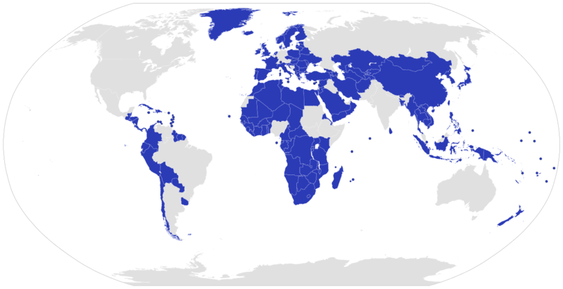
Soubor:Map of unitary states.png
Z Multimediaexpo.cz

Velikost tohoto náhledu je: 800 × 411 pixelů
Obrázek ve vyšším rozlišení (rozměr: 1 280 × 657 pixelů, velikost souboru: 183 kB, MIME typ: image/png)
Mapa + Description:
- English: A map displaying today's Unitary states.
- Comments: The Kingdom of the Netherlands is a federacy but its four parts are unitary states.
- Español: Mapa que muestra los Estados unitarios del mundo.
- Comentario: El reino de los Países Bajos es una federación, pero sus cuatro partes son Estados unitarios.
- Português: Um mapa que mostra os Estados unitários do mundo.
- Comentário: O Reino dos Países Baixos é uma federação, mas suas quatro partes são estados unitários.
- Deutsch: Eine Weltkarte mit Hervorhebung aller Einheitsstaaten.
- Anmerkung: Das Königreich der Niederlande ist ein föderaler Staat, aber seine vier Teile sind Einheitsstaaten.
- Date: 9 September 2007
- Author: Lokal_Profil
+ pochází z Wikimedia Commons, kde má status – This file is licensed under the Creative Commons Attribution-Share Alike 2.5 Generic license. (CC BY-SA 2.5)
Historie souboru
Kliknutím na datum a čas se zobrazí tehdejší verze souboru.
| Datum a čas | Náhled | Rozměry | Uživatel | Komentář | |
|---|---|---|---|---|---|
| současná | 17. 10. 2023, 17:44 |  | 1 280×657 (183 kB) | Sysop (diskuse | příspěvky) | (Fotografie + ) |
- Editovat tento soubor v externím programu (Více informací najdete v nápovědě pro nastavení.)
Odkazy na soubor
Na soubor odkazuje tato stránka:
