Soubor:Kerch strait bridge map.png
Z Multimediaexpo.cz

Velikost tohoto náhledu je: 768 × 599 pixelů
Obrázek ve vyšším rozlišení (rozměr: 984 × 768 pixelů, velikost souboru: 152 kB, MIME typ: image/png)
Mapa + Description:
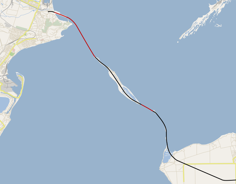
- Русский: Карта нового моста через Керченский пролив (пока только заготовка карты).
- Части моста, располагающиеся полностью над водой.
- Части моста, располагающиеся полностью над сушей (Тузлинская коса).
- English: Kerch Strait bridge map, WIP.
- Above-water parts of the bridge.
- Above-surface parts of the bridge (Tuzla Spit).
- Date: 26 August 2015
- Source: Own work using Maperitive and Inkscape, based on OpenStreetMap data.
- Creator: Nzeemin
+ pochází z Wikimedia Commons, kde má status – This file is licensed under the Creative Commons Attribution-Share Alike 4.0 International license. (CC BY-SA 4.0)
Historie souboru
Kliknutím na datum a čas se zobrazí tehdejší verze souboru.
| Datum a čas | Náhled | Rozměry | Uživatel | Komentář | |
|---|---|---|---|---|---|
| současná | 8. 10. 2022, 16:18 |  | 984×768 (152 kB) | Sysop (diskuse | příspěvky) | (Fotografie + ) |
- Editovat tento soubor v externím programu (Více informací najdete v nápovědě pro nastavení.)
Odkazy na soubor
Na tento soubor neodkazuje žádná stránka.
