V pondělí 16. září 2024 začala naše další
nová soutěž o nejlepší webovou stránku !!
Proto neváhejte a začněte rychle soutěžit o lákavé ceny !!
nová soutěž o nejlepší webovou stránku !!
Proto neváhejte a začněte rychle soutěžit o lákavé ceny !!
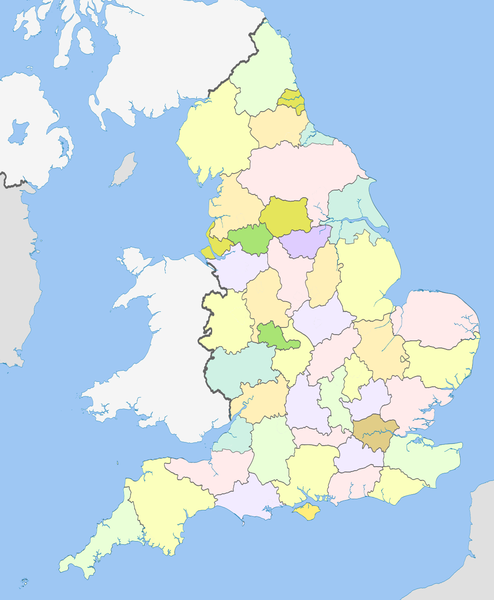
Soubor:English counties 1974.png
Z Multimediaexpo.cz

Velikost tohoto náhledu je: 494 × 600 pixelů
Obrázek ve vyšším rozlišení (rozměr: 1 108 × 1 345 pixelů, velikost souboru: 277 kB, MIME typ: image/png)
Mapa + Description:
- English: Map of the counties of England from 1974 to 1996, excluding the City of London.
- Equirectangular map projection on WGS 84 datum, with N/S stretched 170%
- Geographic limits:
- West: 6.75W
- East: 2.0E
- North: 56.0N
- South: 49.75N
- Date: 19 March 2012, 22:12 (UTC)
- Source: This file was derived from: English metropolitan and non-metropolitan counties 2010.svg:
- Author: Nilfanion
- derivative work: Dr Greg
+ pochází z Wikimedia Commons, kde má status – This file is licensed under the Creative Commons Attribution-Share Alike 3.0 Unported license. (CC BY-SA 3.0)
Historie souboru
Kliknutím na datum a čas se zobrazí tehdejší verze souboru.
| Datum a čas | Náhled | Rozměry | Uživatel | Komentář | |
|---|---|---|---|---|---|
| současná | 3. 3. 2024, 22:38 |  | 1 108×1 345 (277 kB) | Sysop (diskuse | příspěvky) | (Oficiální znak + ) |
- Editovat tento soubor v externím programu (Více informací najdete v nápovědě pro nastavení.)
Odkazy na soubor
Na soubor odkazuje tato stránka:
