Soubor:Barnenez plan d'ensemble.png
Z Multimediaexpo.cz

Velikost tohoto náhledu je: 762 × 600 pixelů
Obrázek ve vyšším rozlišení (rozměr: 3 090 × 2 432 pixelů, velikost souboru: 254 kB, MIME typ: image/png)
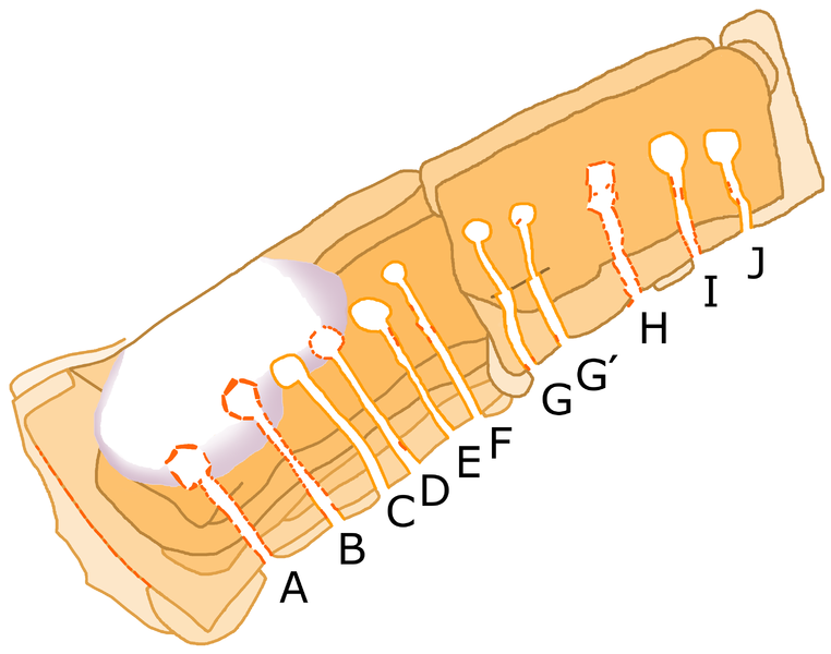
Obrázek + Français : Plan du grand cairn de Barnenez, en Plouezoc'h, Finistère, Bretagne. Plan très approximatif : je n'ai pas trop respecté formes et proportions, ne cherchant qu'à faire comprendre l'organisation. Je me suis basé sur le fichier Commons « Barnenez plan.JPG » d'Athinaios (j'ai fait pivoter « nord en haut » en me fiant à la petite flèche « N »). J'ai corrigé ensuite d'après les plans d'ensemble et de détail figurant dans Pierre-Roland Giot, Barnenez, Carn, Guennoc, Université de Rennes I, 1987, t. II.
- Date: 8 May 2016
- Author: Uuetenava
+ pochází z Wikimedia Commons, kde má status – Creative Commons Attribution-Share Alike 4.0 International license.
Historie souboru
Kliknutím na datum a čas se zobrazí tehdejší verze souboru.
| Datum a čas | Náhled | Rozměry | Uživatel | Komentář | |
|---|---|---|---|---|---|
| současná | 12. 5. 2016, 08:26 |  | 3 090×2 432 (254 kB) | Sysop (diskuse | příspěvky) | (Fotografie + + pochází z Wikimedia Commons, kde má status – ) |
- Editovat tento soubor v externím programu (Více informací najdete v nápovědě pro nastavení.)
Odkazy na soubor
Na soubor odkazuje tato stránka:
